Bridges
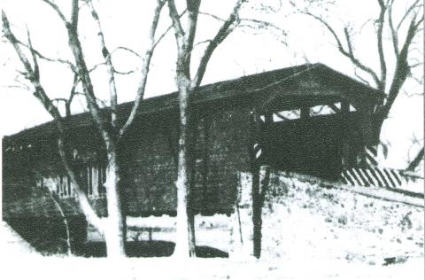
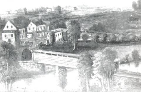
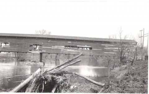
The location of the new township was advantageous in that both the Brandywine and Pocopson Creeks served as power and water resources. But these creeks were also a barrier to road transportation, and a further complication when the creeks flooded – which was all too often. As early as 1685, the Courts ordered the construction of many bridges – most of these replacing established fording spots – which provided easier access to and through what would eventually become the township. The earliest bridges were of wood (covered and open), and later of stone, and then of iron and steel.
One document, thought to date to 1767, spelled out the need for one bridge: “…the Neighborhood as well as Travellers and Market people from some Distance, are under great Difficulty & sometimes danger for want of a Bridge upon the East Branch of Brandywine Creek, on the road leading from Doerun by Joseph Martin’s Tavern to Philadelphia, at the Ford called Taylor’s ford in East Bradford…” It then went on to ask for subscriptions from those “persons Desirous or willing to promote ye building a bridge.” Subscriptions could be in the form of cash, labor or material. That structure was replaced in 1807, and is at the current location of Cope’s Bridge (Route 842).
Among other early local bridges were Embreeville Bridge (formerly Hoopes’) in Newlin Township, over the west branch of the Brandywine (now Route 162); and Pocopson Bridge, across the Pocopson Creek, in Pennsbury Township, near Denton’s Factory (on Denton Hollow Road).
Construction dates for these two bridges are unknown.
Other early bridges are:
- Marshall’s Bridge (1795), over the west branch of the Brandywine, on the road leading from Marshallton to the State Road (Northbrook Road)
- Seed’s Bridge (1834), over the west branch of the Brandywine, on the road from West Chester to Unionville (Route 842)\-Hoopes’ Bridge (1852), at Hoopes’ Ford, on the line between East Caln and West Bradford (Route 322 to Downingtown)
- Brinton’s Bridge (1854) over the Brandywine on the road leading from Kennett Square to West Chester (Brinton’s Bridge Road and Route 100)
- Sager’s Bridge, formerly Wistar’s Bridge (1856) over the Brandywine on the site of an old bridge built many years previously; it is on the road from West Chester to Parkerville (Route 52)
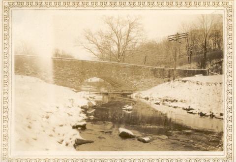
- Painter’s Bridge (1857) at the ford of the same name over the Brandywine, on the line of Birmingham and Pocopson Townships (Route 926)
The area of Painter’s Bridge got some special attention, particularly because the regular flooding of Brandywine Creek would inundate the hollow between the bridge and what later would become the nearby Pocopson railroad station. A row of stone piers was constructed flanking the road, and a heavy guardrail “the size of a telephone pole” was added. This was meant as an ice break.
Author Cornelius Weygandt notes this particular construction in his book A Passing America: “Great stone posts tapering from four feet in diameter at the base to two feet at the top hold logs cemented fast ten feet above the ground. From these great timbers, wooden fences hang, so swung by irons that when the Brandywine is in flood, they will float on the water and let the trees and the debris brought down slip past without injury.” (quoted Rodebaugh)
Share your information!
Help us make this website better! Do you have stories, photographs, maps or other historical information about the Locust Grove Schoolhouse or Pocopson Township? We want to hear from you! Sharing your information can help young people learn about the rich history of Pocopson Township.
Restoration Update

Check out the latest updates on the restoration of the Schoolhouse.